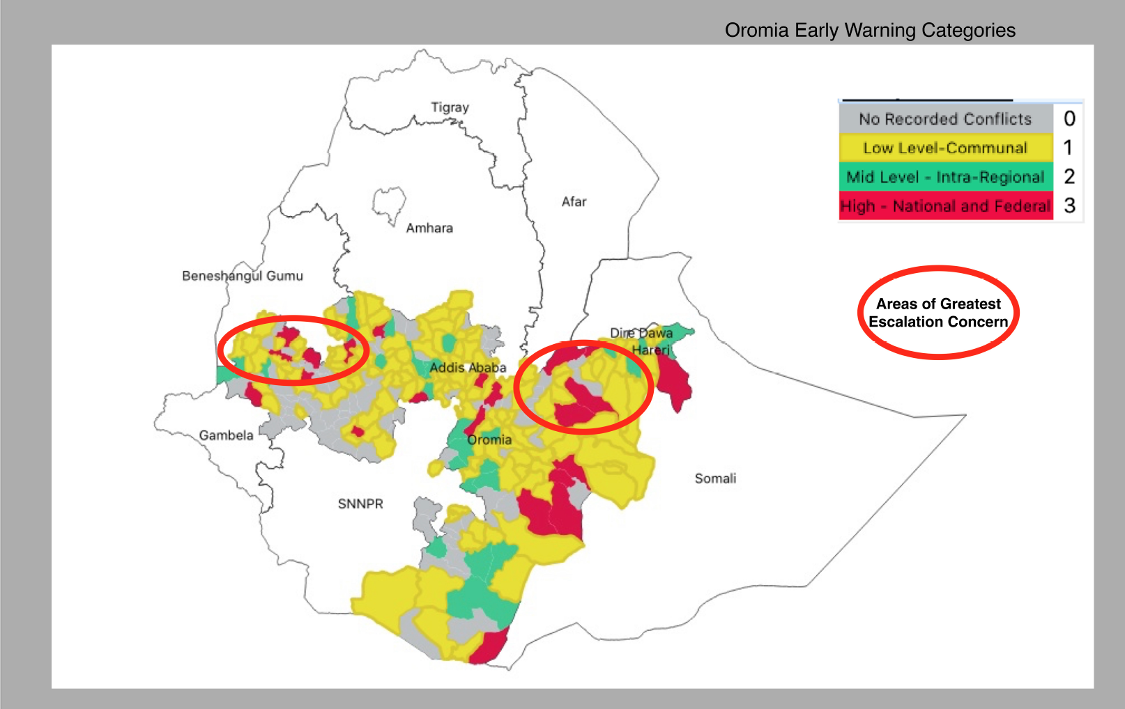
An evaluation of conflict risks in Oromia.
We have developed a methodology to evaluate which woredas have specific forms of conflict, and whether they constitute a good area to invest in for early warning. Further, we have identified where there is a discontinuity in conflict risk, and where very high levels of violence are close to very low levels. These areas are of greatest escalation concern.
This assessment is based on several elements, including:
- the frequency and intensity of the past five years of disorder;
- the number of active, discrete conflict agents present in the woreda at any time in the past five years;
- the main type of agent active in these spaces over the past five years;
- the population density of the zone;
- the level of homogeneity in the identities of the population.
We have broken the cases down into four categories, each with a specific type of unrest:
[table id=1 /]
We used a GIS file containing 261 Oromia woredas. We then associated ACLED data for the Oromia region and integrated all additional data. We identified the scales based on a stratified system of sorting and then developed a map reflecting these scales.


